-
Object Detection and Classification
She worked with the city of Jakarta Indonesia as part of the Data science for social good fellowship to build a system which uses object detection and classification to find and label objects, semantic segmentation to determine where they are (on road / sidewalk / wrong lane) and optical flow to determine movement in order to build a video-processing pipeline for the city of Jakarta to extract structured information from raw traffic footage.
So, in the end we can know whether things like motorbikes are moving on the sidewalks, forcing pedestrians onto the road or at what times of the day people driving cars tend to move in the wrong lane, causing more traffic on that road so the city can deploy their limited traffic officer at that particular intersection at specific times of day for example or even build a boundary.
This system was to help the city make more medium to long term solutions mainly in order to improve traffic safety.Evolution and effects of spatial apartheid
Her master's work is on using satellite images and machine learning techniques to study the evolution and effects of spatial apartheid in South Africa.
Here she is using machine learning to classify neighborhood from satellite images of South Africa and then look at specific neighborhoods like townships overtime to compare resources like hospitals and schools in relation to the number of people living there and then comparing those ratios to the ones in suburbs over time.
Top 15 Young Geeks - Class of 2020
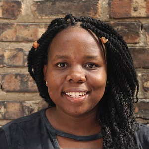
Raesetje Sefala

- Organisation:
- Role:
Raesetje's Biography
Address World Problems - Data Science
Raesetje is passionate about what she does. Not only is she focused on technical problem solving but she is also passionate about seeing more women in the space, doing quality computational science related research.
She is also the founder of the women in computational science research community. A non-profit organisation which aims to create a community which empowers and encourages the growth and participation of women in the field of Computational Science Research and in the long term to improve the quality of their work.
Raesetje is a young black data scientist/machine learning engineer/problem solver who is ambitious and passionate about what she does.
She is mainly interested in using machine learning to analyse and possibly help solve problems experienced in developing countries. She is a young innovator and has worked on several projects with multiple institutions including the CSIR and the University of Chicago. Some of the projects she has worked on are listed below.
Favourite Quote
I never lose. I either win or learn. - Nelson Mandela
Dear South African Geeks,
This community inspired me to become a Geek and now I aim to inspire the next generation.
Thank you!
- Raesetje Sefala